If I told you I hiked to Crater Lake, you might say which one? There are at least ten named Crater Lakes in the state of Colorado and two that are in the northern Front Range mountains in neighboring wilderness areas. While both are worthy destinations, I’m reviewing the day hike to Crater Lake(s) in the James Peak wilderness, a much more accessible day hike.
Railroad History
The trail head for Crater Lakes is located off the Rollins Pass Road at the Moffatt Tunnel. As you drive to the trail head, you will be traveling the path of history. Rollinsville started as a mining town, which went through its own gold rush during the late 1880s. The mining era coincided with the building of the railroad intended to connect Denver to Salt Lake City. Built over a high mountain pass, topping out at 11,660 feet, the railroad climbed to the highest elevation of any railroad in the country.
As you might expect in the mountains of Colorado, bad winter weather frequently hampered operations, often bringing the trains to a halt. In 1928, the Moffatt Tunnel opened, providing an easier, more efficient way through the Continental Divide. This route is still used today by freight trains and Amtrak’s California Zephyr, taking a mere 12 minutes for trains to reach Winter Park.
Motorists continued to use Rollins Pass as a 4-wheel drive route from Rollinsville to Winter Park until the early 1990s. When the Needle’s Eye stone tunnel collapsed, the route closed for good. Today, off road vehicles still drive up from the east and west side just shy of the tunnel, to see the old wooden trestles built for the train that are mostly still intact.
James Peak Wilderness
To hike in the James Peak Wilderness, turn left at the junction for Rollins Pass, parking at the large gravel lot just east of the tunnel. Almost immediately after starting the trail, you enter the James Peak Wilderness, named for Edwin James, the first botanist to visit the Rocky Mountains. Ironically, to climb the most direct route up James Peak, you must another hour up I-70 west to St. Mary’s Glacier.
But for our hike, we will start at the tunnel, walking the main trail towards Rogers Pass. The trail is wide, no doubt a remnant of an old mining road. The first mile alternates between pine and fir forest, and open meadows. As you pass the meadows, bursts of yellow Golden Banner and purple Chiming Bells will greet you.
A Well Earned View
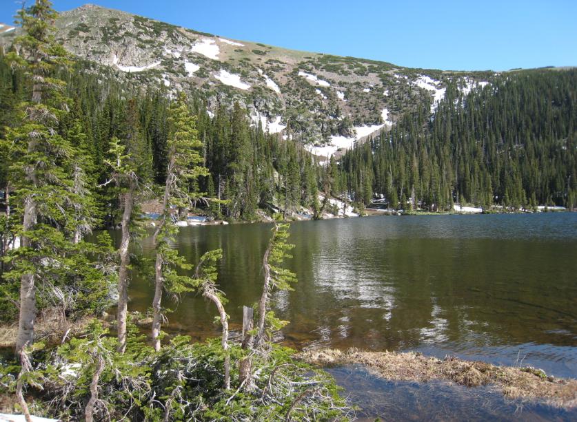
After two miles, you reach the junction with the Crater Lakes Trail. Though it is only a mile to the lower Crater Lakes, you will earn that view by climbing steeply up rock steps and many switchbacks before leveling out as you approach the lower Crater Lake. The trail leads to the left between the two lower lakes. Most of the campsites for lower Crater Lakes will be located on the western shore.
To reach the upper lake requires a scramble up some loose scree and rock. Either is a worthy destination. There are plenty of rocks and logs to enjoy lunch and the lovely view of the mountains and lakes. For most hikers, the total round trip hike of six miles will take 3-4 hours.
On weekends when nearby Brainard Lake and Hessie Trailhead can be packed with people, East Portal provides a more peaceful alternative with plenty of parking. A walk to Crater Lakes is filled with flowers, forest and lake side views making for a lovely morning hike.